
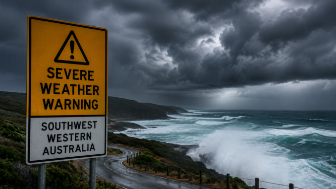
Residents across southwest Western Australia are being urged to prepare for dangerous weather conditions as an unusually strong cold front moves across the region, bringing destructive winds, heavy rainfall and hazardous coastal conditions throughout the long weekend.
The Bureau of Meteorology has issued a severe weather warning, describing the approaching system as “unusually strong and intense” for this time of year. The front is expected to sweep through the state’s southwest districts later today and overnight, impacting communities from the South West to the Great Southern regions.
Forecasters warn that damaging wind gusts could exceed 100 km/h in exposed coastal areas, with some locations at risk of locally destructive winds capable of bringing down trees, damaging property and causing power outages.
Heavy rainfall is also forecast, raising concerns about localized flooding, dangerous driving conditions and disruptions to transport networks over one of the busiest travel weekends of the year.
Along the coast, authorities are warning of particularly dangerous marine conditions. Offshore swells are expected to reach up to eight metres, while powerful surf and abnormally high tides are forecast between Gregory and Cape Naturaliste.
Emergency services have urged residents to secure loose outdoor items, avoid unnecessary travel during peak storm conditions and stay away from beaches, coastal rock platforms and flooded waterways.
The warning comes as thousands of Western Australians prepare to travel and enjoy outdoor activities during the long weekend. Authorities are reminding the public that weather conditions could deteriorate rapidly and that official updates should be monitored closely.
The Bureau of Meteorology is continuing to track the system and says further warnings may be issued if conditions intensify.
Emergency crews remain on standby across affected regions as the powerful weather system approaches the state’s southwest coast.

Be the first to comment