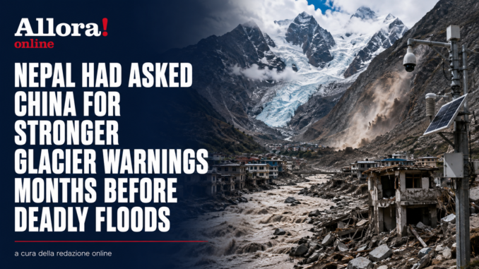
Three months before the catastrophic floods and mudslides that devastated the Nepal-Tibet border, Nepali and Chinese officials had already met in Kathmandu to discuss the growing danger from floods, glacial lakes and glacier-related hazards. According to Reuters, Nepal had asked China for faster and more detailed data sharing. Beijing says it provided information in a “timely manner”, while experts stress there is no evidence that either side caused or could necessarily have prevented the disaster.
The revelation comes as the scale of the Himalayan disaster continues to grow.
According to the latest figures cited in the report, nearly 800 people have been killed across Nepal and China and more than 3,000 remain missing, after a glacier collapse unleashed a massive torrent of water, mud and rock through the border region.
The May 27 meeting
On May 27, 10 Nepali officials and about a dozen representatives from China, including experts from Tibet, met in Kathmandu.
The agenda included flood monitoring, weather risks and glacier-related hazards.
Officials discussed possible joint measures including inventories of glacial lakes and improved hazard mapping.
But two Nepali officials told Reuters that Kathmandu did not receive as much information as it wanted on glacier movement and water levels following the meeting.
Hydrologist Sauhardra Joshi, who attended the talks, said Nepal wanted earlier warnings if unusual movements were detected around glaciers.
China says warnings were shared
Beijing has rejected criticism that it failed to provide sufficient warning.
China’s embassy in Nepal said the two countries had made “substantial progress” in cross-border disaster information sharing and that Chinese teams had provided important information in a timely way.
China had also begun sharing forecasts of heavy rainfall in Tibet through WeChat and email around a month before the disaster.
Twelve days before the catastrophe, China’s World Meteorological Centre warned Nepali officials of enhanced rainfall and the possibility of secondary hazards including landslides and flash floods.
Nepal wanted more specific data
The concern from Nepali officials was that most of the information focused on rainfall.
They wanted more frequent data on:
- glacier movement;
- avalanches;
- river levels;
- landslides;
- sudden extreme events.
Kathmandu is now pushing for a more formal system of real-time information exchange.
Just minutes to react
The timeline of the disaster shows how little warning communities may have.
At about 8:32am Nepal time, the flood had already smashed through a border crossing in Tibet.
Twenty-six minutes later, Nepali authorities received an alert about flooding on the Trishuli River.
Several monitoring stations had stopped transmitting, apparently because they had been destroyed by the flood.
A public mobile-phone warning was sent at 9:13am.
A massive wall of water and mud
The flood travelled about 168 kilometres downstream from the Nepal-China border.
According to Nepali government assessments, it carried around 57.4 million cubic metres of water, more than 50% above normal levels.
The disaster damaged 19 bridges, around 40 kilometres of highway and knocked out more than 10% of Nepal’s power-generation capacity.
One resident described what approached his village not as ordinary floodwater, but as a huge wall of mud.
Climate change increases the risks
Preliminary assessments point to the collapse of a glacier as the trigger.
The Hindu Kush Himalaya contains the world’s largest volume of ice outside the polar regions, with more than 63,000 glaciers.
Scientific research has found that climate change is accelerating glacier melt, reducing snow cover and making snowfall more erratic.
Those changes are expected to increase the risk of floods, landslides, erosion and other mountain hazards.
Nepal wants updates every 10 minutes
Kathmandu now wants to establish a data-sharing agreement with China similar to the one it already has with India.
The proposal would involve receiving information on rainfall and river levels as often as every 10 minutes.
The goal is simple: gain enough warning time to evacuate communities before disaster strikes.
“We can warn our people, save our people,” hydrologist Binod Parajuli said.
The issue is not about assigning blame.
Experts cited by Reuters say the glacier collapsed in a remote and poorly monitored area and that limited cooperation between Nepal and China was not a major factor in causing the catastrophe.
But the disaster has exposed a critical weakness.
In the Himalayas, water and collapsing glaciers do not stop at national borders. When a flood can move from one country to another in minutes, real-time data sharing is no longer just diplomacy — it becomes a matter of saving lives.